ExamineAI
First page of ZIMSEC O-Level Geography 2000 Question Paper

ZIMSEC O-Level Geography 2000 Question Paper

Download and practise with this ZIMSEC O-Level Geography 2000 question paper. Useful for exam revision, past paper practice, and preparation in Zimbabwe.

A free account is needed to download. Sign in or create one

Exam board
ZIMSEC
Subject
Geography
Level
O-Level
Document
Question Paper
Year
2000
File
PDF, 5.0 MB

About this question paper

This is the ZIMSEC O-Level Geography question paper from 2000. Use it for exam practice under timed conditions.

More Geography O-Level 2000 papers

Other years: Geography O-Level

Text from the first page

Mapwork
Questions 1 to 12 refer to the 1:50 000 map of Gwanda (Zimbabwe).
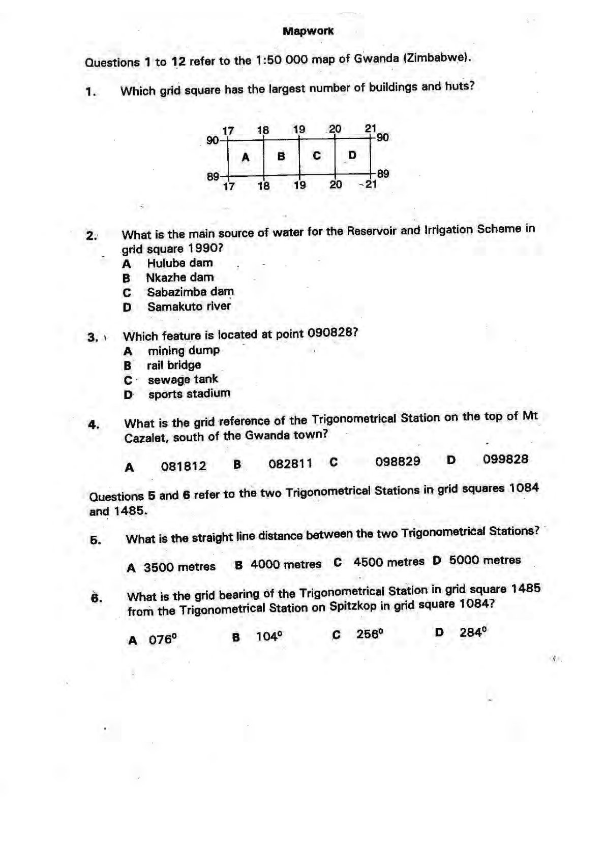
1. Which grid square has the largest number of buildings and huts?
2. What is the main source of water for the Reservoir and Irrigation Scheme in grid square 1990?
A Hulube dam
B Nkazhe dam
C Sabazimba dam
D Samakuto river
3. Which feature is located at point 090828?

A mining dump
B rail bridge
C sewage tank
D sports stadium
4. What is the grid reference of the Trigonometrical Station on the top of Mt Cazalet, south of the Gwanda town?

A 081812
B 082811
C 098829
D 099828
Questions 5 and 6 refer to the two Trigonometrical Stations in grid squares 1084 and 1485.
5. What is the straight line distance between the two Trigonometrical Stations?

A 3500 metres
B 4000 metres
C 4500 metres
D 5000 metres
6. What is the grid bearing of the Trigonometrical Station in grid square 1485 from the Trigonometrical Station on Spitzkop in grid square 1084?

A $076^{\circ}$
B $\quad 104^{\circ}$
C $256^{\circ}$
D $284^{\circ}$